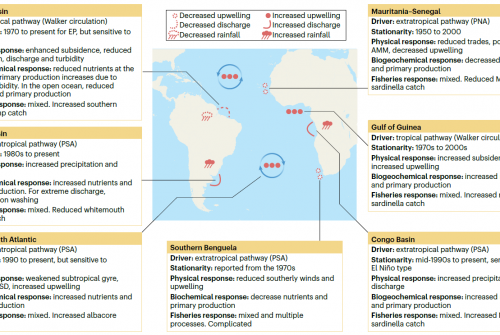
Sea surface salinity (SSS) is a key variable for ocean–atmosphere interactions and the water cycle. Due to its climatic importance, increasing efforts have been made for its global in situ observation, and dedicated satellite missions have been launched more recently to allow homogeneous coverage at higher resolution. Cross-shore SSS gradients can bear the signature of different coastal processes such as river plumes, upwelling or boundary currents, as we illustrate in a few regions. However, satellites performances are questionable in coastal regions. Here, we assess the skill of four gridded products derived from the Soil Moisture Ocean Salinity (SMOS) and Soil Moisture Active Passive (SMAP) satellites and the GLORYS global model reanalysis at capturing cross-shore SSS gradients in coastal bands up to 300 km wide. These products are compared with thermosalinography (TSG) measurements, which provide continuous data from the open ocean to the coast along ship tracks. The comparison shows various skills from one product to the other, decreasing as the coast gets closer. The bias in reproducing coastal SSS gradients is unrelated to how the SSS biases evolve with the distance to the coast. Despite limited skill, satellite products generally agree better with collocated TSG data than a global reanalysis and show a large range of coastal SSS gradients with different signs. Moreover, satellites reveal a global dominance of coastal freshening, primarily related to river runoff over shelves. This work shows a great potential of SSS remote sensing to monitor coastal processes, which would, however, require a jump in the resolution of future SSS satellite missions to be fully exploited.
Referencia
Dossa A.N., Alory G., Costa da Silva A., Dahunsi A.M., Bertrand A. 2021. Global analysis of coastal gradients of sea surface salinity. Remote Sensing. 13: 2507.


